
This map I found at our cabin in a drawer and it it shows the Pinecrest area lakes and trails from over 100 years ago. Click on the map image to get a full screen size image.
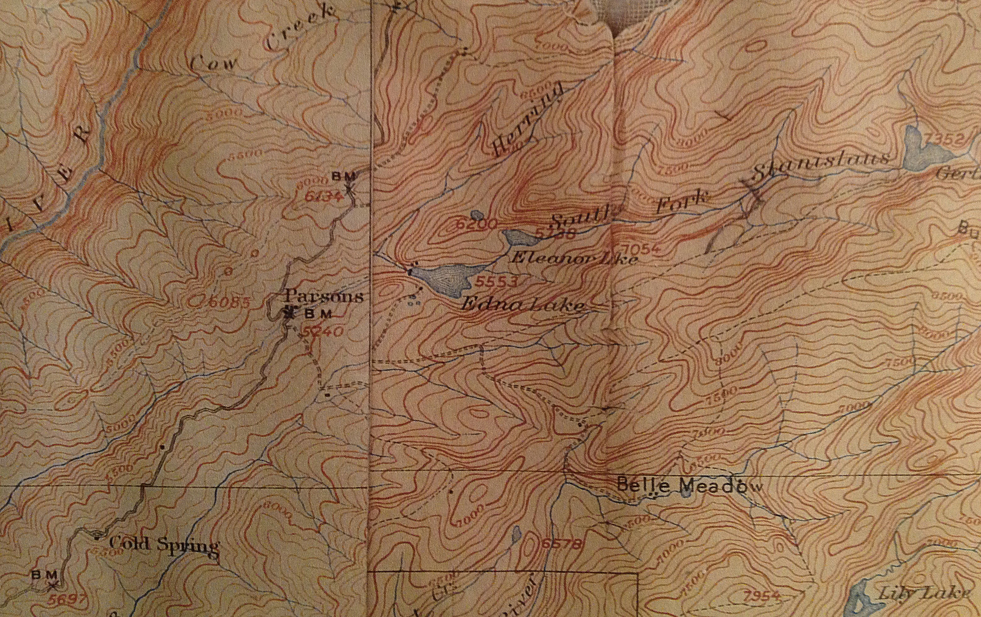
1906 Topopgraphical map of Pinecrest area found in a drawer at our cabin in Pinecrest.
If anybody has information and or photos from this period of the lakes and trails, please share them so we can post them on this site.
Observations:
- Pinecrest lake was originally named Edna Lake. This lake existed with a smaller, wood based dam structure that made a smaller sized lake.
- Parts of the dam for the Lake above Pinecrest called Eleanor Lake still exist today and you can find incredible rock work and metal bars in the granite on the trail toward Cleo’s baths. Can you can see waterlines on the rocks showing the water level for this lake and many other clues.
- Almost next to the current Waterhouse lake level is Gertrude Lake which was also removed and burned out. Water house is to the left of Gertrube Lake.
- A town of “Parsons” appears to be current Strawberry.
- A trail appears to take off from the current Crabtree road and head up all the way to Gertrude Lake. If you discover this historical alignment to a current trail or forest service road, please let us know. The accuracy of the topographic information is not perfect.
