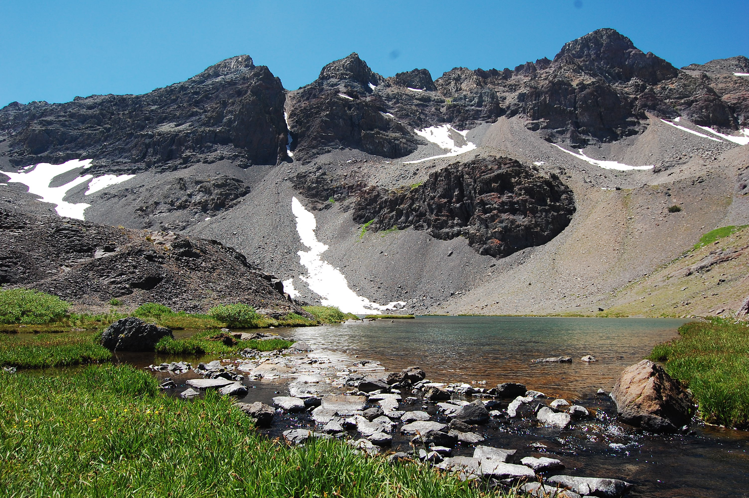
This is a favorite trail and a hidden gem. There is no signage along the row that shows you the trail head so you just have to know where to park and start the trail. This is a short distance but a slow, uphill hike at a very high elevation and some scree to walk over.
- 3.1 miles round trip – 1100 feet elevation climb.
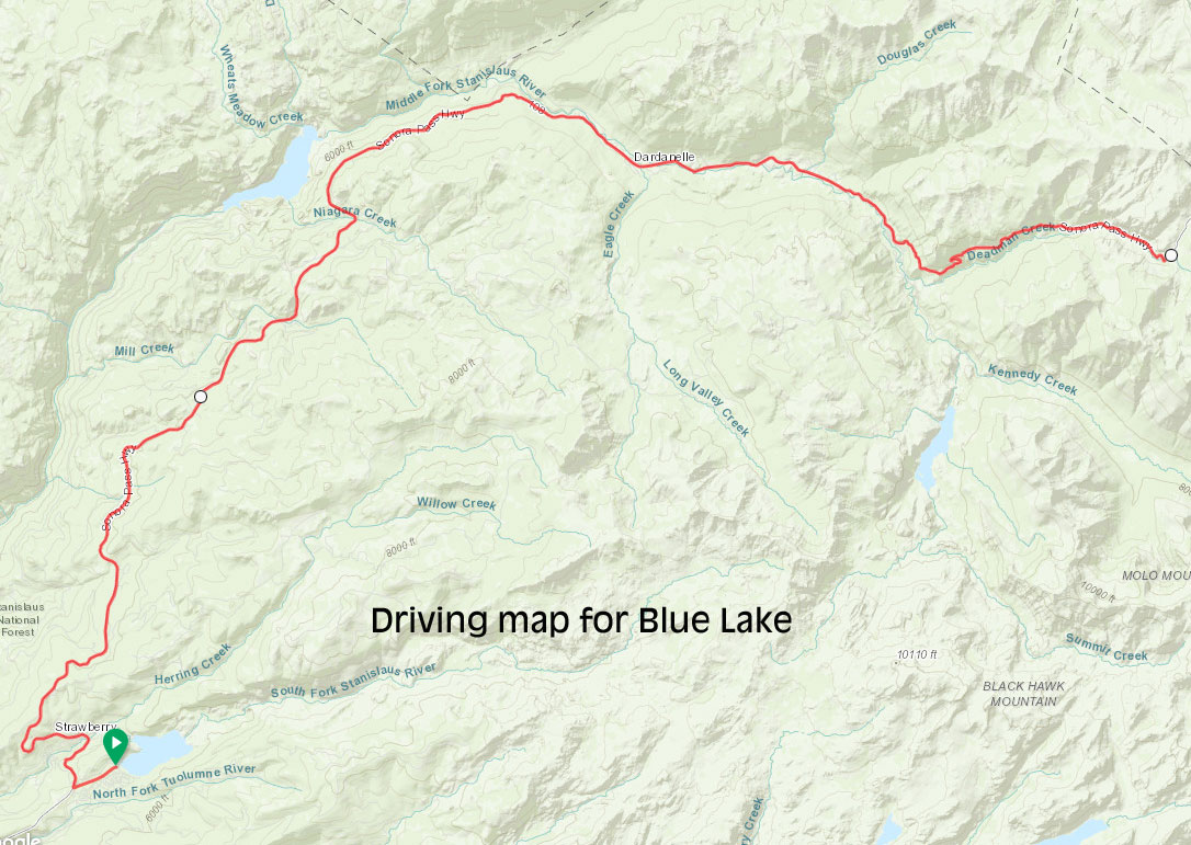
Here is the driving map to the parking on the side of the road. There is room for about 3 cars and other parking nearby.
To start this hike, drive to the small parking area on the right hand side of the hwy (heading east). Then immediately scramble down the rocks next to the parking area and cross the creek and go up the other side. You should see the trail from others infront of you.