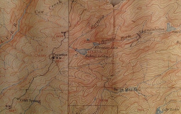
The USGS started publishing maps of this region in the early 1900’s and we have shared some USGS maps dating back to about 1907 showing the previous configuration of “Pinecrest Lake” , the group of cabins called Edna and the town of “Parsons” and the previous set of lakes and dams above the current Pinecrest lake.
Did you know Pinecrest was originally labeled “Pine Crest”? Sometime the space was dropped and the single word spelling that is now used. Pinecrest lake was originally called Strawberry lake until the about 1970’s?
If you have any historical maps you would like to share, please electronically scan them in the best quality possible and send them to us for sharing.