
Here is a list of Pinecrest adventures in 2020!
NOTE: Most of these hiking and biking routes recommend using the on-line topo map that shows these exact routes defined here.
This is an on-line map. To access this before you go on out on your adventure and lose cell data service, you should research your route ahead of time and navigate to the route you want.
It is probably best to grab a PDF map ahead of time on your phone and save it and then reference it on the trail without internet
Click below to view a PDF of most of the trails on the topo map
PinecrestTrailsJune2020-1 (PDF)
and then make appropriate screen shots of the zoomed in map region you need ahead of time!
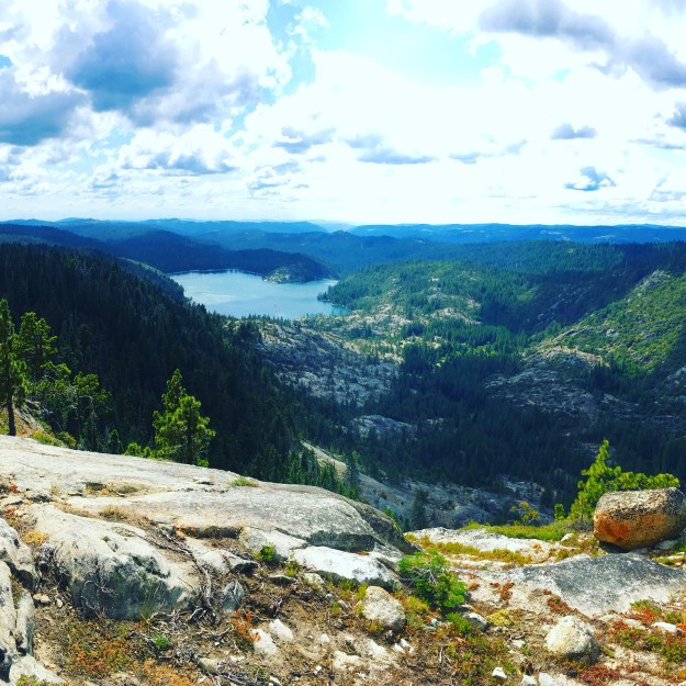
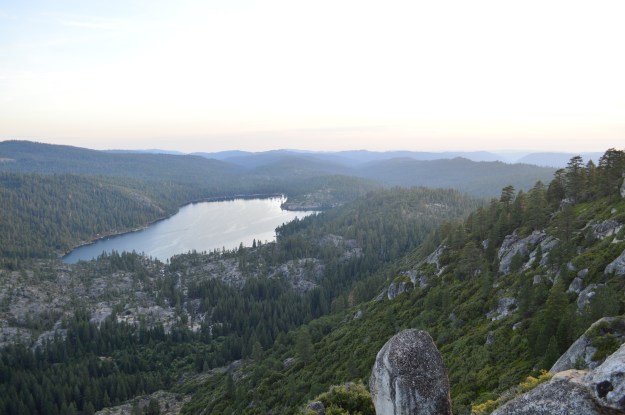
View from the South Wall Overlook
Activities avoiding the Pinecrest Lake Recreation Area – 2020
Biking
https://pinecresttrails.org/pinecrest-to-strawberry-biking-loop/
This is the one the best, shortest loop that takes to from Pinecrest to Strawberry and back with almost no biking on Hwy 108. You cross 108 twice and on the road for a just a short bit.
View this route on RideWithGPS
Biking to Dodge Ridge
- Its about 3.8 miles one way and 1000 feet of climbing on the Dodge Ridge Rd to go from Pinecrest. It pretty much up all the way up and flying down on the way back.
Downhill Mountain Biking
Many Mountain bike riders in the area have helped to create a network of Downhill mtn bike trails. These are often step and meant to be ridden by riders that do this type of biking and in the downhill direction.
- One of the longer trails is to bike up to Pinecrest Peak and then take the bike trails all the way back to strawberry.
- Trail from Dodge Ridge Rd near the Gooseberry Rd to Pinecrest
Please refer to trail map available at the hub in Pinecrest
Biking on FS roads
There are many longer dirt/mtn biking routes you can do on FS dirt roads
There are some that start right out of Pinecrest!
The FS road FS-4N68Y that connects to FS-4N11 can take you many miles in one direction, often fairly flat as many of these roads were previous logging railroads.

Hiking in Pinecrest
LOCAL Hikes First will be hikes you can do right from Pinecrest cabin/beach/camping area without getting into a car to drive to a trail.
Pinecrest Lake trail – 4.0 miles,
– Can be very busy but offers swimming, views, and connections to Cleos bath trail and other places. One can run around the lake on the trail in less than an hour. Hiking takes closer to 1.5 to 2 hours.
https://pinecresttrails.org/pinecrest-lake-trail/
North Wall Overlook
For a longer 1/2 day to full day 78 mile, 1364 elevation climb hike from Pinecrest, the Pinecrest North Wall – Lake Overlook is a fun route.

https://pinecresttrails.org/pinecrest-north-wall-lake-overlook/
Pinecrest Peak – 11 miles – 2500 feet
This longer route is fairly full day hike with lunch stop. In the photo you can see how far away Pinecrest lake is in the far distance! This is an out and back loop.

https://pinecresttrails.org/pinecrest-peak/
Pinecrest – Strawberry hiking route via the lake and river to strawberry
This 4.8 mile route is goes along Pinecrest lake to the Dam down to Strawberry and then back up to Pinecrest. This is a 2-4 hour hike.
https://pinecresttrails.org/pinecrest-strawberry-loop/
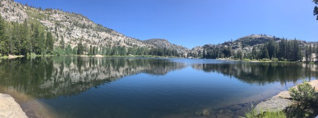
South Wall Overlook From Pinecrest
This 6.6 mile roundtrip hike takes about 3-5 hours with 1500 feet of vertical.
You start this hike at the Carl Ski Hill (Junction of Fir Rd and Cliff Lane. Go up the closed off road that goes up the old ski hill and take the trail. About 400 feet Before you reach the group campsites at the top, turn left on the trail.
Parts of this trail may be hard to find at times. Look for markers that say SWO – South Wall Overloop. This is on the online topo version.\
Cleos Bath
This 7.0 mile roundtrip hike takes you to swimible pools in the canyon above Pinecrest lake and offers swimming in the lake on the way there and back. This loop takes the easterly side route on the lake on the way out and the westerly/dam route on the return route. To shorten it, take the easterly /southerly route in both directions. 735 feet of vertical.
There is some rock scrambling near the very end that requires holding onto to trees and rocks and climbing vertical for a short bit.
This trail and swimming hole at the turn around point can be busy. Only swim in the pool when water levels are low enough to swim safely.
This route is on the on-line topo map
https://pinecresttrails.org/cleos-bath-hike/
Waterhouse Lake Loop from Pinecrest – 16 miles + – Trail and route still in development
This longer route is still being developed but there are already existing trails to where you can do a longer 16 mile loop by starting in Pinecrest, and hiking up the South or North side canyon to Water house lake and then return via the ridge on the opposite side.
This is only possible when the river is lower, typically late June in dryer years and July in wetter months. You need to cross the river. One other option is to go up and back on the north side of the Stanislaus river so you don’t need to cross it and all trails/roads required to access Waterhouse from Pinecrest are well defined.
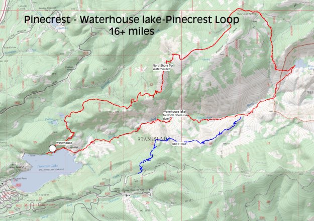
https://pinecresttrails.org/waterhouse-lake-loop/
Hiking Adventures that you drive to start your hike or overnight trip
The two best local forest service roads to access the wilderness are either the Crabtree Road or the Herring Creek Road. Both of these roads start within about 3 miles of Pinecrest. Each one can take you to trail heads that are over 8000 feet.
Crabtree Road hikes
To get to the crabtree road, drive up the Dodge Ridge Road until you reach the “Y” one way section. Turn right onto a short connector road to Crab tree. Then turn right on Crab Tree road.
The first set of hikes is at the Crab Tree Trail head. This is a better trail head for earlier in the year if there is still snow at Gianelli trail head which can happen into July.
From this trail head are two lake destinations – Camp Lake and then farther Bear Lake, both offer swimming.
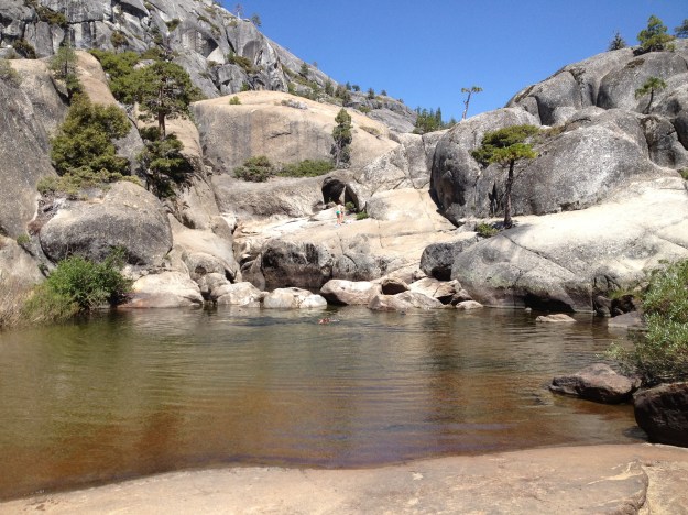
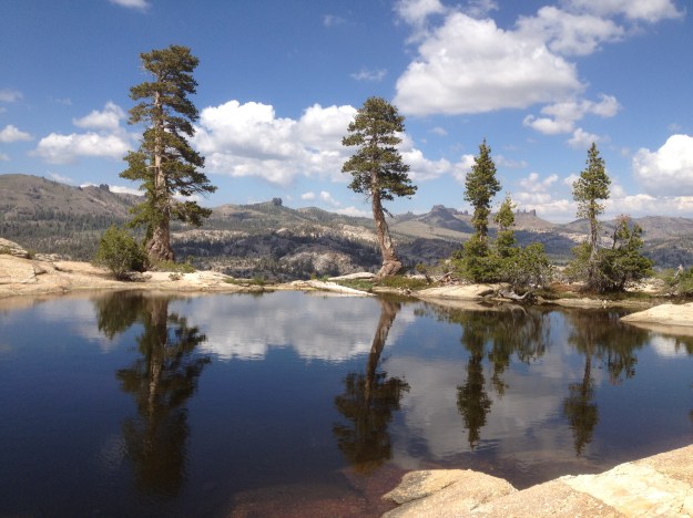
A second trailhead at the end of the crabtree road is the Gianelli Trailhead. This offers numerous day nights, or multiple day overnights trips to Burst Rock, Powel Lake, Chewy Gum Lake and beyond. We have found a unique small swimming lake near (just north about 1/2 mile) to Powel Lake.
This unique granite lake is just north of Powel Lake. It is unique in that it is like an infinity pool!
Another un- marked trail at the Gianelli Trail Head is Marmot Lake and Bell Creek Falls
https://pinecresttrails.org/marmot-lake/
If you time your hike at the right time of the years, these falls are amazing to visit and cool off under!
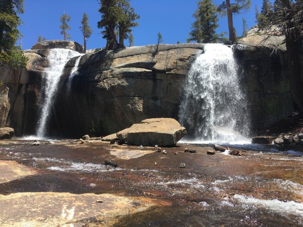

Marmot Lake – below Bell Creek Falls
Herring Creek Road Hikes
Herring Creek is located up (east 108) about 4-5 miles east of Pinecrest junction. This road can be gated at various points until it has opened up.
The two hikes are:
Pinecrest North Wall Overlook or Pinecrest Peak
https://pinecresttrails.org/pinecrest-north-wall-lake-overlook/
Water House Lake 2.8 miles roundtrip
This is a longer drive on dirt road that may not be greatly surfaced. Carefully follow the road directions below or on the Waterhouse lake hike page.
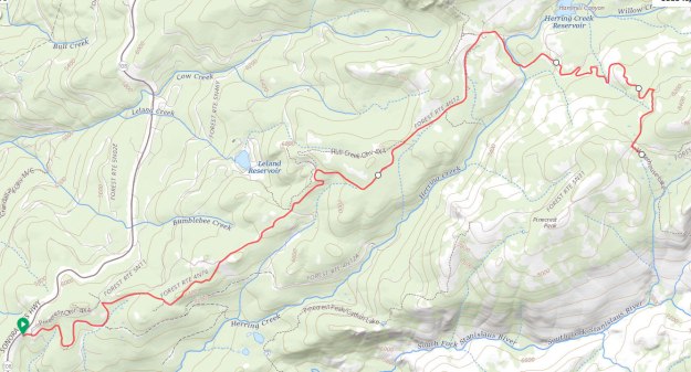
This just the map for the drive to the trailhead for water house lake
This shorter 2.8 mile loop from the trailhead has a 1/3 mile very steep rocky section.
This route works as a day hike or a overnight trip too. This route is on the on-line topo map.

Website page for this hike/overnight camp
https://pinecresttrails.org/waterhouse-lake-hike-overnight/
Nature Journaling, photography, etc
There are many options for nature journal, photography and other botanical studies around Pinecrest area.
Photography at the lake in the evening or morning is nice.

https://artinpinecrest.org/nature-journaling/

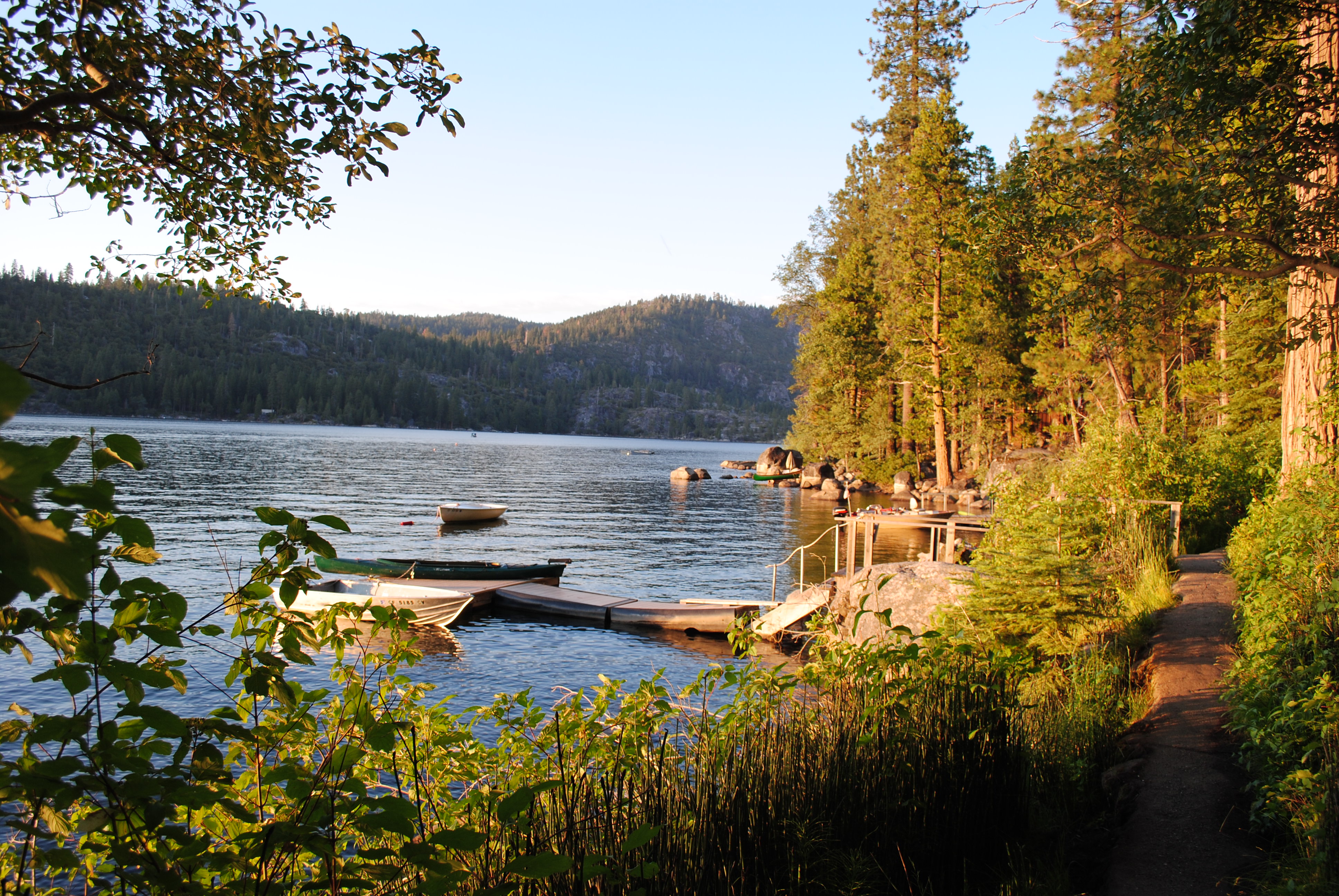
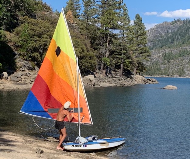
Kayaking, canoe, and sailing adventures
Pinecrest lake is a perfect smaller lake for taking a paddle or sail.
Runs and running around the Pinecrest area
There are several runs from the Pinecrest cabin area. A good morning run is around the lake, about 4 miles, 50-60 minutes. Can be tricky and slow in places.
A shorter loop exists going toward the dam and then up to the water tanks and out to the ranger station area and back to the lake area.
Other loops include:
https://pinecresttrails.org/karls-hill-pinecrest-loop/
You could do the Pinecrest/South Wall overloop – 8 miles – about 2 hours running
Hike and adventures more than 45 minutes driving time from Pinecrest
Secret Lake
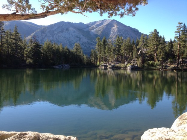
This shorter hike goes to an excellent swimming lake.
Driving directions – Drive over Sonora pass to the Leavit Meadows Trailhead, about 50 miles from Pinecest.
Park here in this lot. Walk through the Leavit Meadows Campgrounds and cross over the footbridge that cross the West Walker River.
At the first trail junction in about 1/4 mile, take the fork to the right for the quickest route to the Secret Lake.
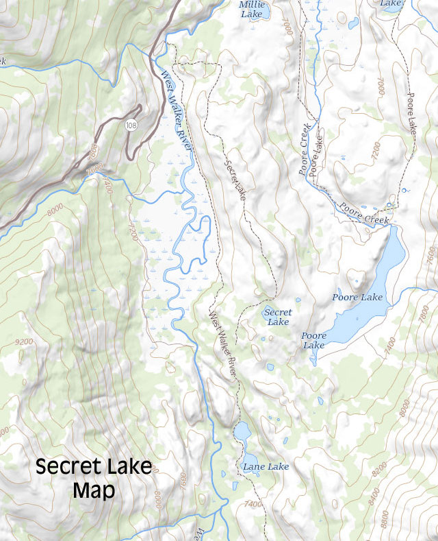
https://pinecresttrails.org/secret-lake/
Blue Lake and Blue Canyon Hike
This 3.1 mile round trip hike is straight up and straight back hike starting about 9000 feet climbing to around 11,100. It seems to take a full day with the drive and hike and lunch.
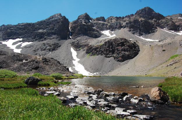
The trail head for this trail is not marked on the 108 highway but it is about 1/4 mile before the 9000 feet elevation sign on the western side of the summit / Sonora pass.
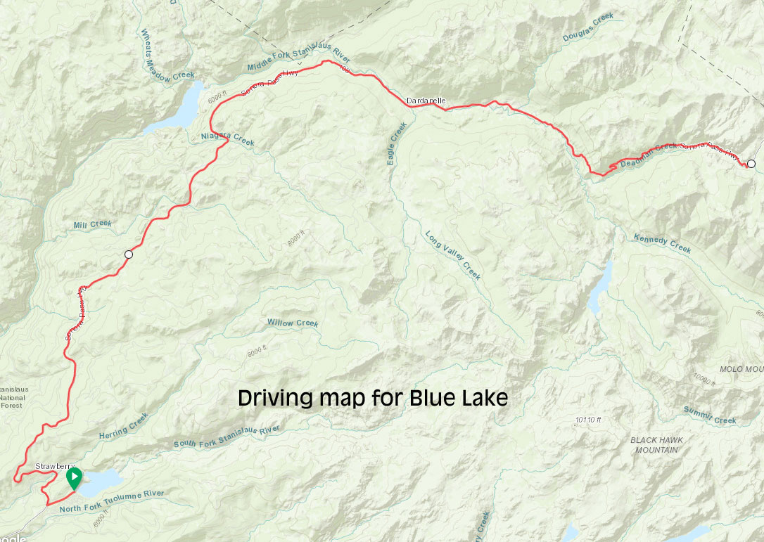

https://pinecresttrails.org/blue-lake-and-blue-canyon/
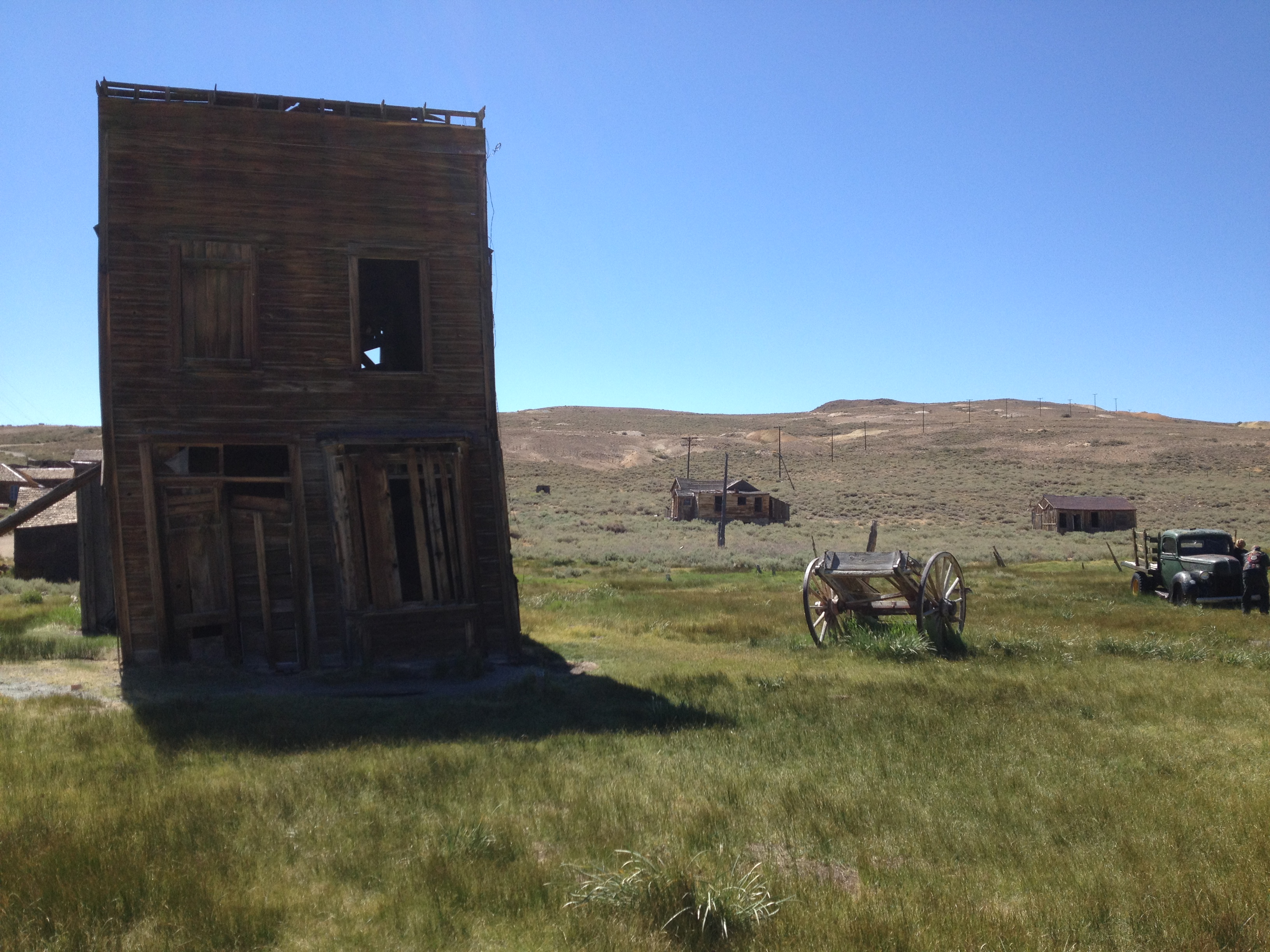
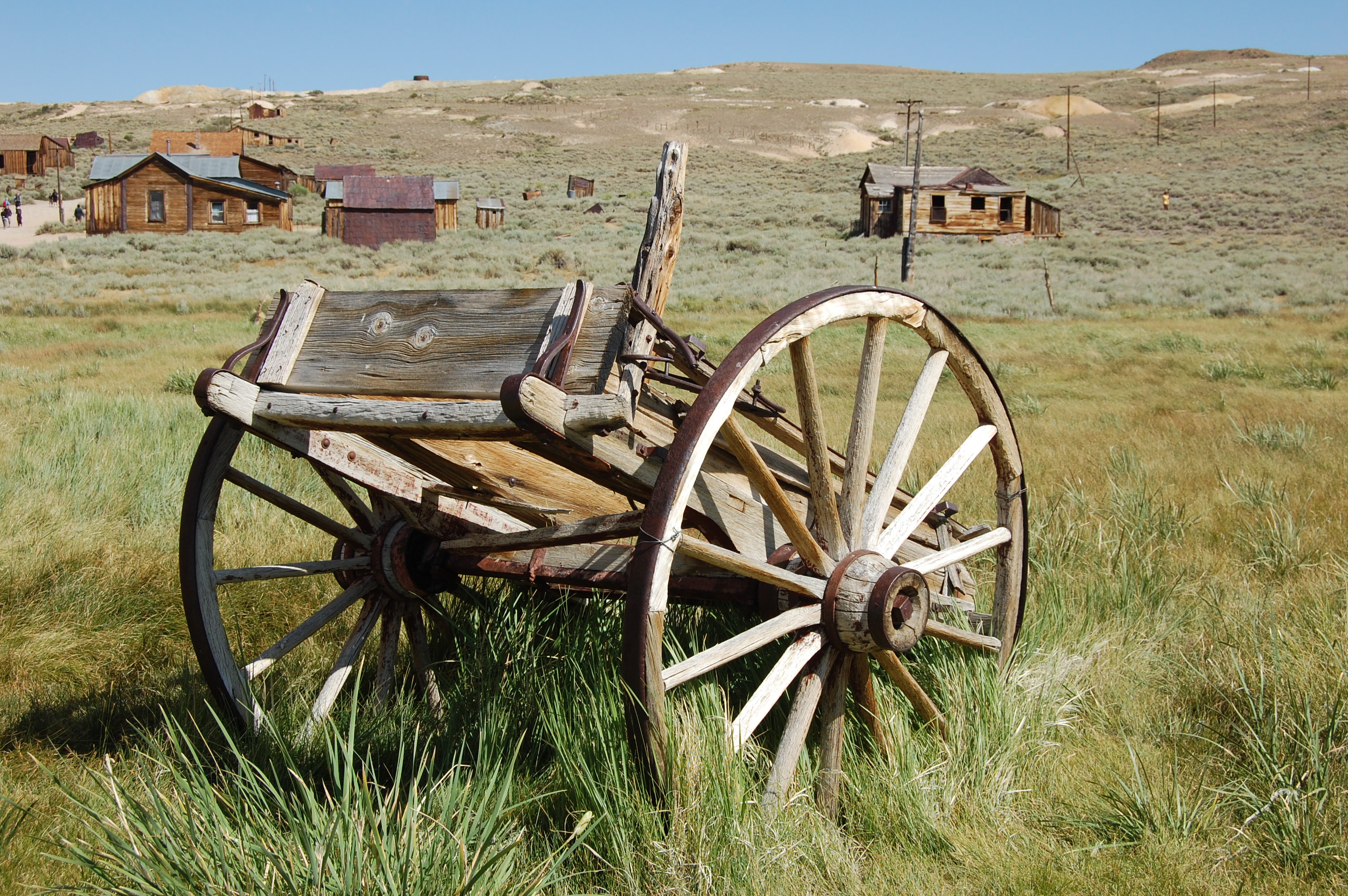
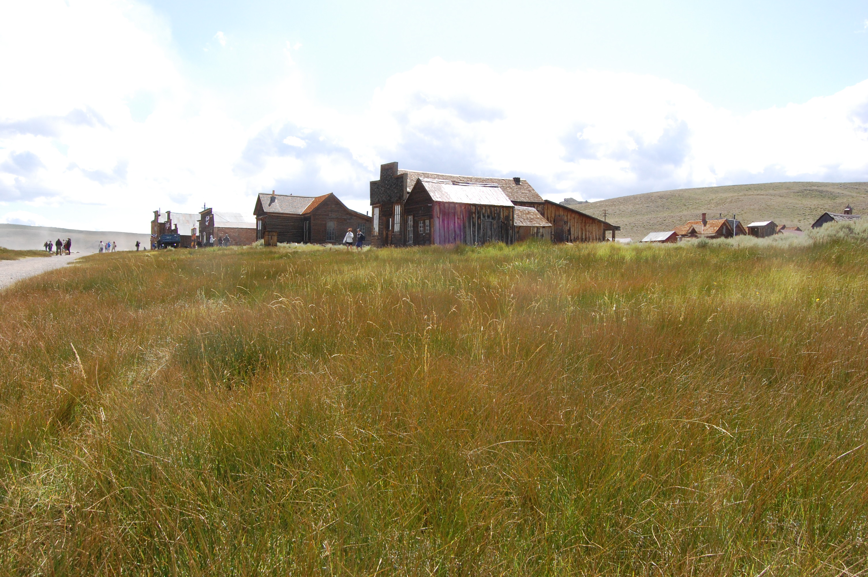
Photography and hot springs
If you are a photographer, a full day outing to Bodie is a worth while trip.
Bridgeport and Travertine Hot Springs and Bodie are all on the eastern side on 395. This is a 1.5 hour drive to Bridgeport and another 45 minute drive to Bodie. Its about a 4-5 hour drive to Bodie and back to Pinecrest.
If you have the time to drive over 108 to 395, there are three interesting places to go
Bridgeport is a fun small town and just outside of Bridgeport are the Travertine Hot Springs
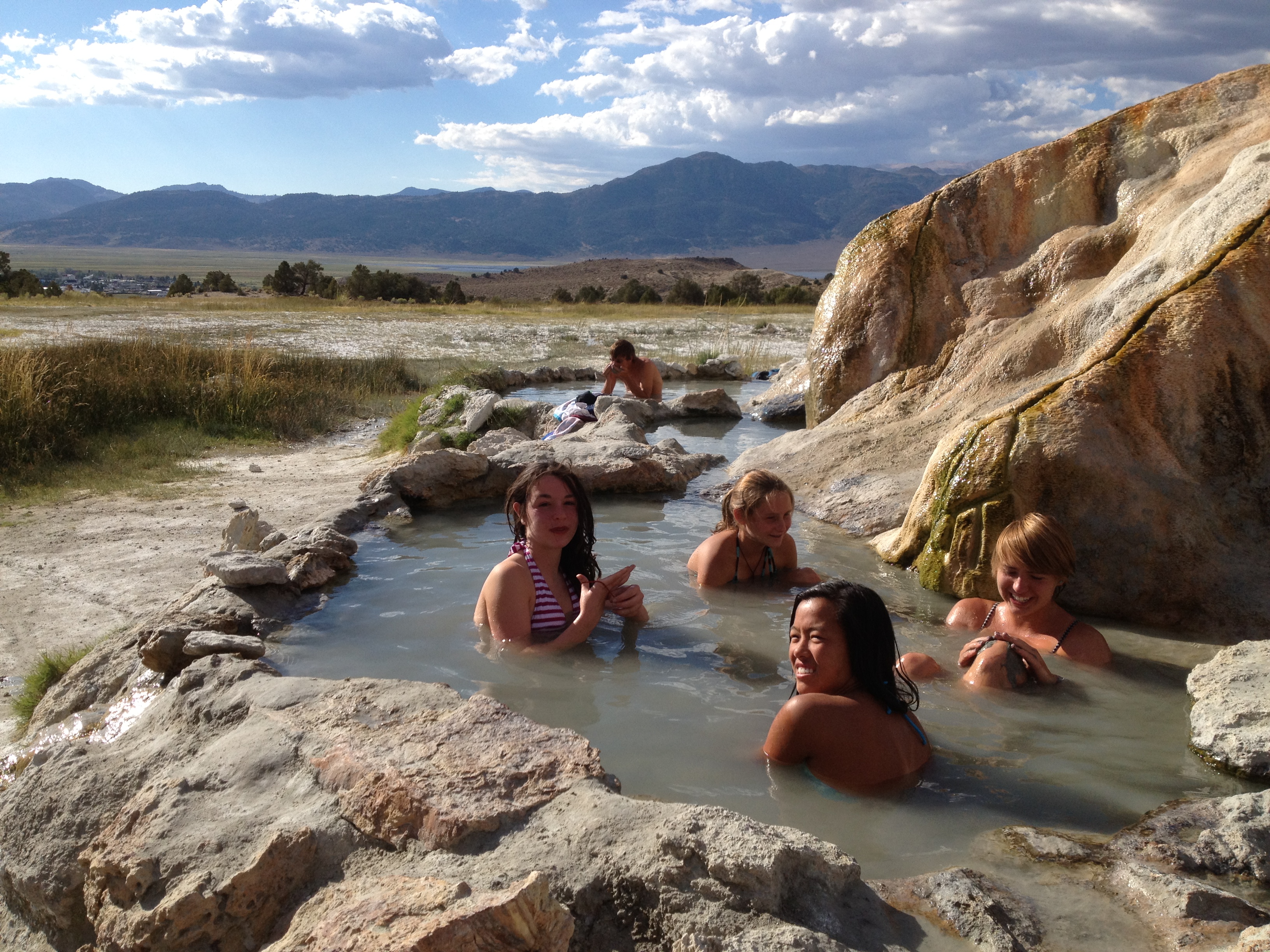
About another 30-45 minutes on Hwy 395 and up a paved and then dirt road is the historic ghost town of Bodie
Photography
