

Pinecrest Lake Overlook – South Peak – Local peak of rock
As you look down the lake from the westerly shore, you can see two sides of these large granite rock mountains. Getting to the top of those rocks to get a view back to the lake is not an easy task.
This is a hike to the southerly peak to get a view back to Pinecrest lake.
To get to this point, DO NOT attempt to climb from the eastern side of the lake side shore and work your way up the rock above Cleos bath of the steep faces below.
Instead it is far easier to access this tip of the canyon by coming off of the Gooseberry creek Rd area and going across at the 7040 feet elevation contour. Plan to do some bushwacking through the forest to get to these two view points.
The fastest way to access this point is to drive up the Gooseberry Rd about 1.5 miles until you cross a stream that has washed out the road. About 20 feet beyond that washout is a parking area on the left. Park here and find the trail that goes up the hill near the parking area. Follow that trail to the South Wall Over look.
I was able to hike out and back in about 50 minutes total while starting at that parking location on Gooseberry.
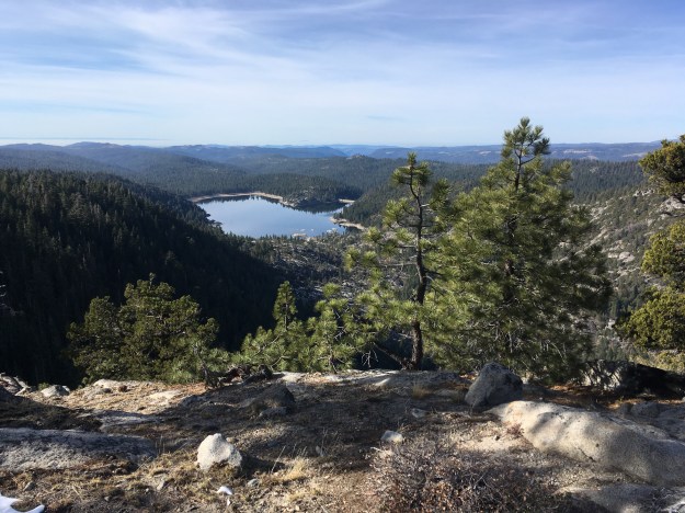
View from Juniper Point – December 28 2017

Pinecrest Lake Overlook – South Canyon Wall – Juniper Point – Fall 2017
If you wish to continue toward water house lake and easterly beyond Juniper Point, simply follow the contours around the corner of the slope and you will immediately find yourself on the flatter open areas facing to the eastern slope of the sierras. (See photo below) . You can bushwack through rocks and brush to work your way easterly. There isn’t much elevation climb for almost a mile but it is hard to find a path without thick brush or large rock to get around.
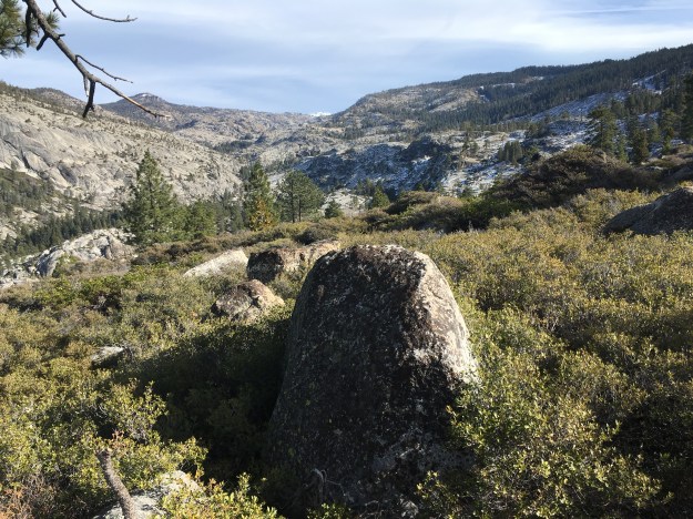
View looking east once you have rounded the end of the cliff at Juniper point.
The first viewpoint will be to scramble to the top of this one local rock peak. A second view location is about 500 yards to the north to take you to Juniper Point.
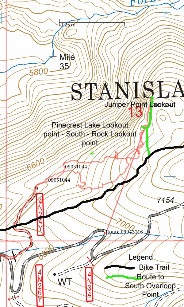
Map showing the South lookout points. We originally starting hiking from the end of 4N24Y but it is easier to leave the bike the trail at about the 7030 foot elevation to reach the lookout points.
