
Pinecrest Peak is probably the best, full day hike right from Pinecrest. It is about 11.2 miles round trip and about 2500 feet of elevation climb. This hike takes you to the former Pinecrest peak FS lookout station location which is just below the peak. Until about the mid 1970’s, a small fire lookout station was perched on the side of the mountain at near Pinecrest Peak.
This hike is on the on-line topo and the PDF.
A version of this hike is also available on RideWithGPS at
The real Pinecrest Peak elevation wise, or the highest point has no real views as the peak area rolls off gently with surrounding trees. Instead, this other location where the original fire lookout station existed is more commonly referred to as Pinecrest Peak.
We use to hike to this lookout station in the 60’s and 70’s and walk around the deck of this tiny all glass windowed station.
8,440′ elevation.This lookout was originally built as a National Defense Observation Tower during World War II.It was manned from 1939-1973. It is no longer standing. You can still see some of the metal that is bored into the rock where this structure existed.

Pinecrest Peak Lookout station previously existed at the end of your hike.
It offers several rewarding views that are a few steps away from the trail that look down into the steep canyon behind Pinecrest and views to the North and East once you reach the peak location. If you are looking for a high Sierra wilderness experience with a walk from Pinecrest, this will take you up into the granite of the high country.
- Details: About 11 miles round trip
- Time: At least 5 hours hiking time
- Elevation: 2500 feet vertical climbing (Pinecrest 5600 feet to Peak 8200 feet)
- Very Limited water resources – You can filter water at Catfish lake, or Heart pond if high enough.
Other Trail Options:
If you still want to hike to Pinecrest peak but limited on time, there is an option to drive about 1/2 way up and connect to the peak trail off of the Herring Creek Road (from Hwy 108/Herring Creek – 4N12 and then after about 2M, turn right onto 4N12A for about 3/4 mile. The road will end at a large, closed bridge crossing Herring Creek. Park here and walk over the bridge and continue on that trail until you intercept the Peak trail. This route is about 4-5 miles total round trip, 2-3 hours. (See map for details)
Directions:
Start by taking the Pinecrest Lake trail toward the Dam. Cross the dam and after the about the 3rd cabin you reach pass the dam, you will see a small sign that points to Catfish Lake. Turn left onto this trail. In about 1 mile you will past Catfish lake, which there is actually 3 ponds/ lakes. First is a small shallow pond, second you come to larger lake, which is also NOT the real Catfish Lake. The real, even larger catfish lake can be visited by turning left at trail junction at the very first pond. To reach the peak, do not turn left at the junction. Continue up the trail. You will cross a logging road in about 1 more mile. Continue up for another 1.5 miles. About 1/8 mile pass where you cross the logging road is a turn off to North Wall Overlook. The peak / lookout spot is a nice location for lunch. Back track to Pinecrest with options to continue around the lake once you return back to the lake.

View back toward Pinecrest lake about 2 miles from Pinecrest lake turnoff.

View from trail about 4 miles from Pinecrest lake

View from Pinecrest Peak Lookout station location – End of trail – Connects with Peak Road – That tiny lake in the distance is Pinecrest lake!
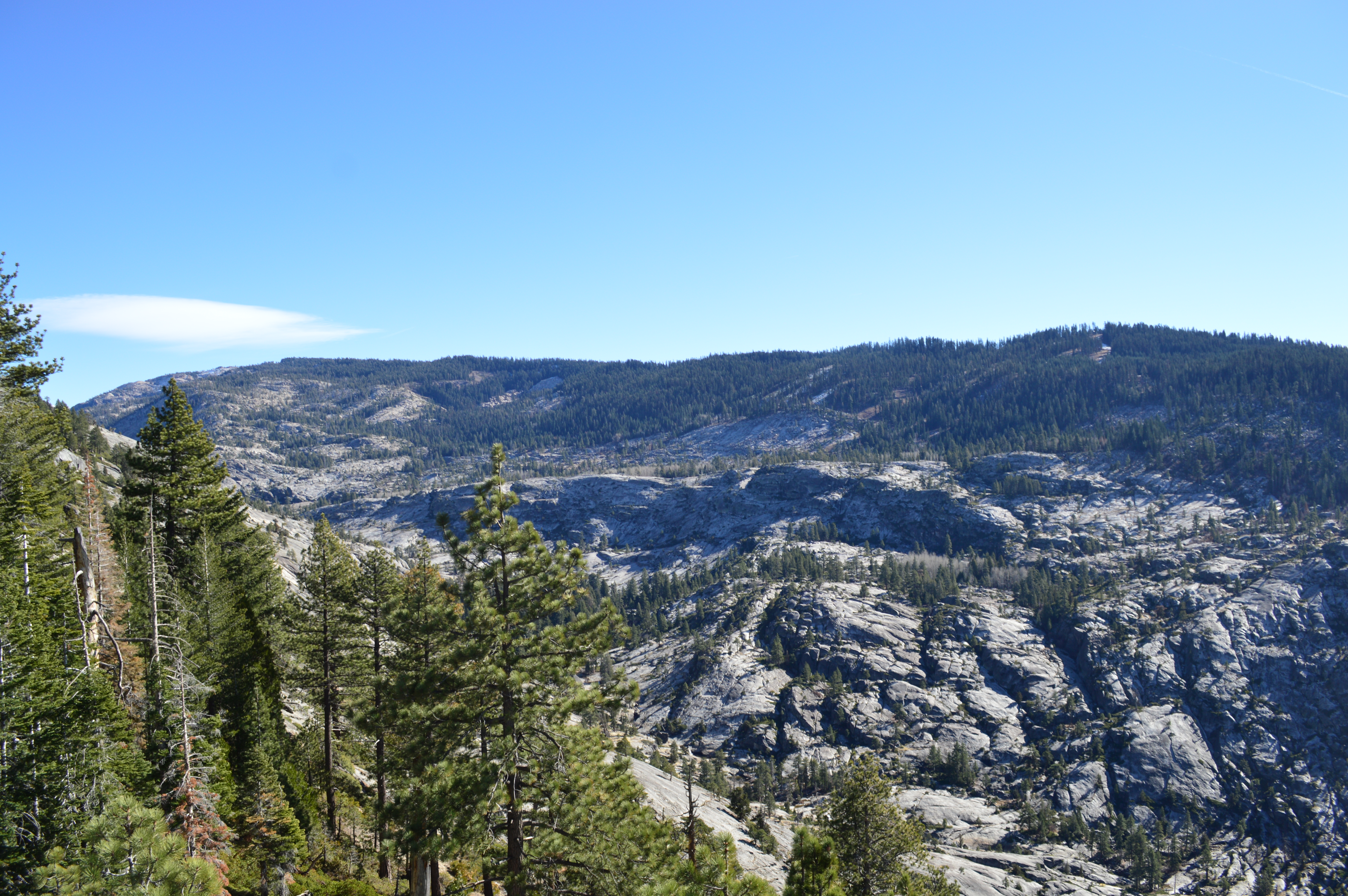
View from the trail various vista points looking into the Canyon.

Lots of great views looking South, West and Easterly
Maps:

Thank you for posting this! I heard about this hike but was having a hell of a time finding the actual trails. The description is really helpful– thank you!
LikeLike